digital unfolding of reality through augmented interpretative representation
Dür.air is a mobile augmented reality application conceived as a field-based extension of the scientific and epistemological framework developed within the n-Dame_Heritage project. Its name reflects its core ambition: the digital unfolding of reality through augmented interpretative representation — reconciling observation, interpretation, and documentation at the place and moment where scientific observation is produced, by embedding spatial, temporal, and semantic information directly within in situ investigation.
In archaeology, conservation–restoration, architectural history, materials science, and landscape studies, knowledge emerges through situated practices: inspection, comparison, measurement, annotation, and the progressive construction of interpretative hypotheses. Where 3D digitisation often separates acquisition and interpretation in time and space, dür.air keeps geometry, semantics, and observation tightly coupled in a single mobile and autonomous environment.
Combining persistent augmented reality tracking, real-time LiDAR sensing, and on-device photogrammetric reconstruction, the platform supports a progressive “unfolding” of the object or site — an evolving augmented representation built across successive field sessions. On a single device (currently iPad Pro or iPhone Pro with LiDAR) and without network connectivity, it covers the full chain of field documentation: annotation, structured semantic description, metric measurement, dense 3D modelling, orthophoto and profile computation, interactive analysis, and the replay of spatio-temporal observation trajectories. Geometry remains a support for interpretation, memory, and cumulative reasoning.
When connectivity is available, projects can be deposited on a server node for institutional archive, sharing, and web publication — while field work itself stays fully offline.
A short overview of dür.air in the field: persistent AR, LiDAR sensing, on-device reconstruction and semantic enrichment.
Field stories, public projects and documentation from the dür.air community.
Recent field experiments documenting how dür.air is used in real heritage research contexts.

In situ documentation of a 15th-century manuscript: rectified photography, spatialised annotations and light photogrammetry.
10 June 2026 · Aix-en-Provence
Rapid photogrammetry and spatialised annotation on cast mouldings at the Galerie des moulages.
6 June 2026 · Paris
Polychrome sculpture study combining voice annotations, alteration mapping and spatialised LIBS analysis.
20 May 2026 · LRMHA curated selection of public projects highlighted on this dür.air node.
Join the dür.air community through live training sessions and the beta testing program.
Following a few months of beta testing, we are organizing a live presentation and training webinar for current and future dür.air users. The sessions will introduce the application’s main features and guide participants through the complete workflow, from field acquisition and geometric reconstruction to semantic enrichment, data export, and web publication.
We are currently recruiting the first group of beta testers for dür.air. The beta program is open to heritage researchers and professionals interested in testing the application in real fieldwork situations and contributing feedback to improve the system.
An institutional hub where offline field work becomes archive, shared knowledge, and web publication.
A server node is the institutional counterpart to the offline app: a self-contained web application (Docker) that an organisation runs under its own authority to host affiliated users and projects, publish vocabularies and annotation templates, and moderate community exchanges. Its administration modules are summarised below.
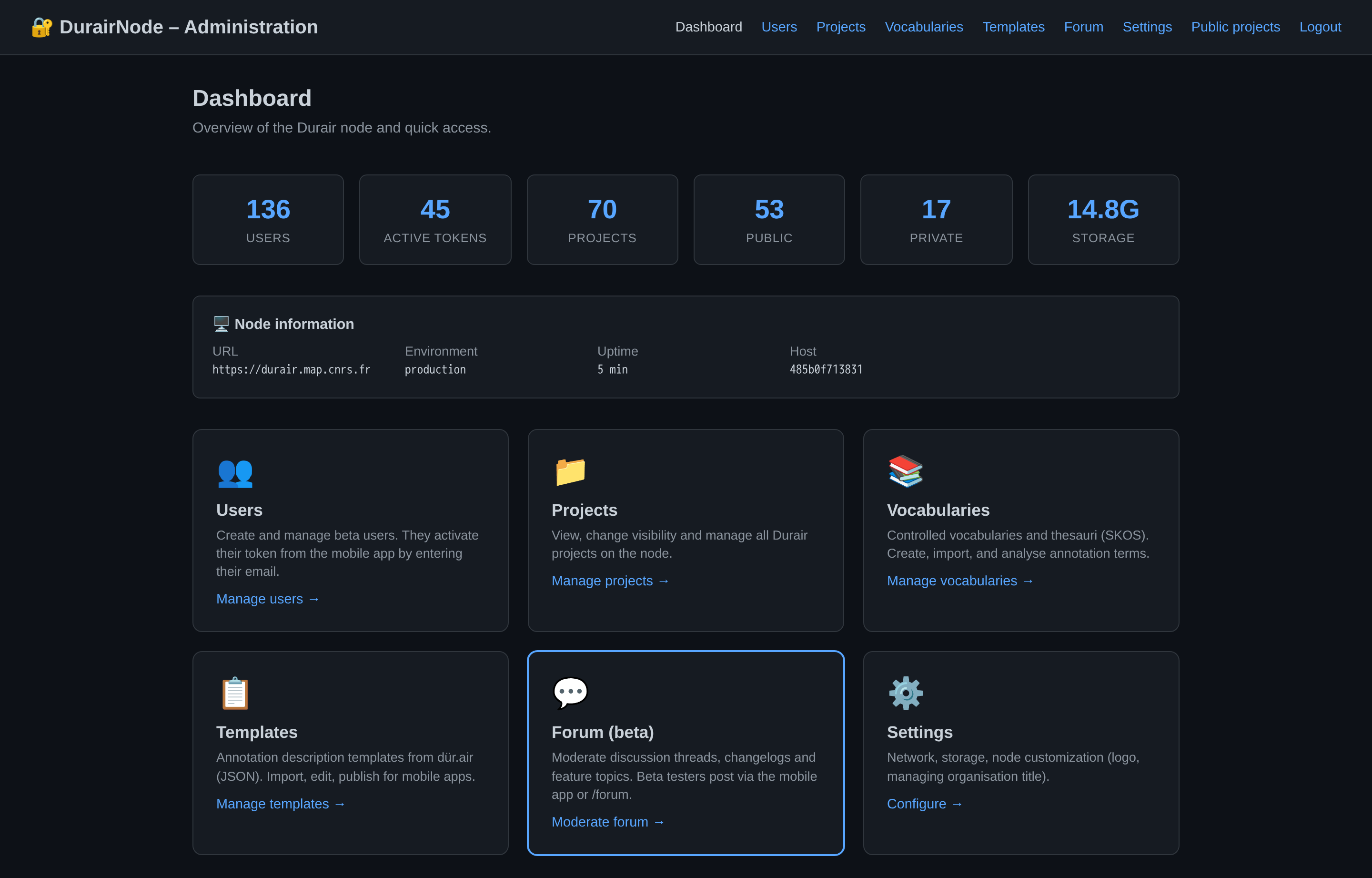
How an app connects. The user configures the node’s public URL and activates access with their registered email; the node issues a personal token used for sync (upload, vocabularies, templates, forum). Field work stays offline; the node is contacted only when the user chooses to sync.
Deployment & cooperation. The server node will be available for deployment in cultural institutions and research laboratories, with installation documentation. Nodes can optionally join a cooperative federation protocol: each institution keeps an autonomous node while participating in a shared network for discovery and cooperation across the dür.air ecosystem.
dür.air is developed at the CNRS MAP laboratory (UPR 2002) within the ERC project n-Dame_Heritage (ERC-2021-Advanced Grant), in connection with the Notre-Dame de Paris scientific action. Complementary support has been provided by CNRS MITI, the French Ministry of Culture, the Fondation des Sciences du Patrimoine, EquipEx+ ESPADON, and E-RIHS ERIC.