1. Persistent spatial anchoring
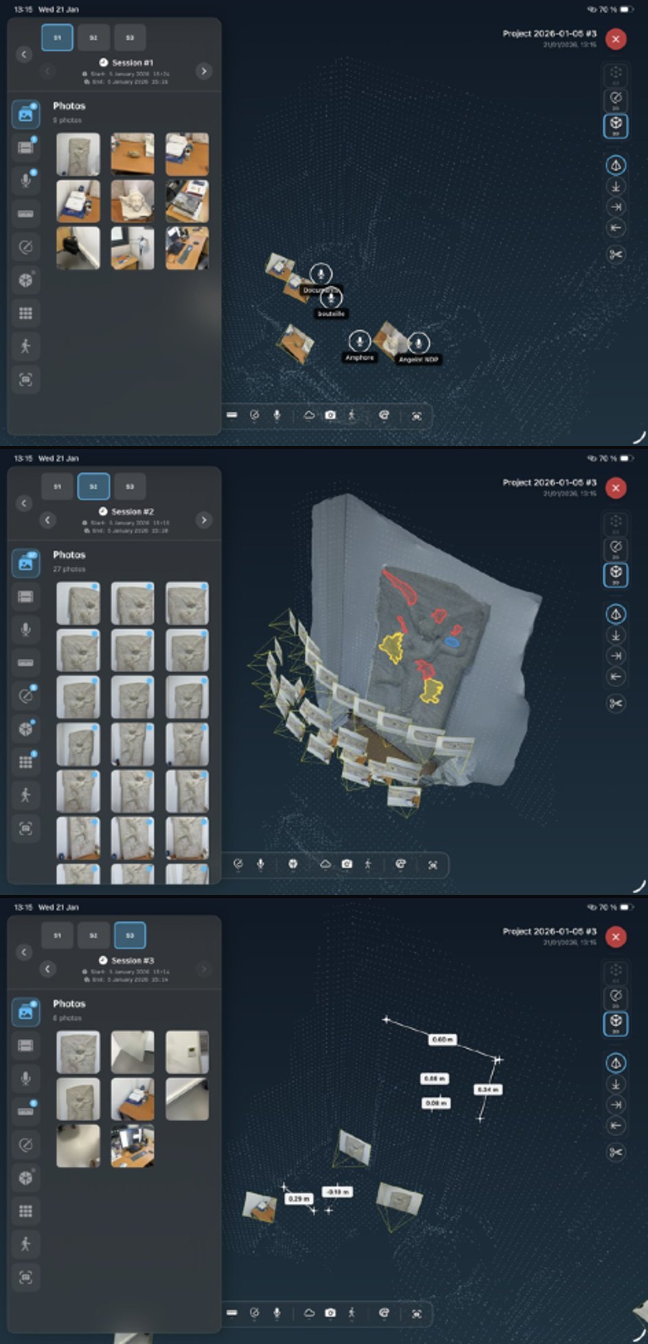
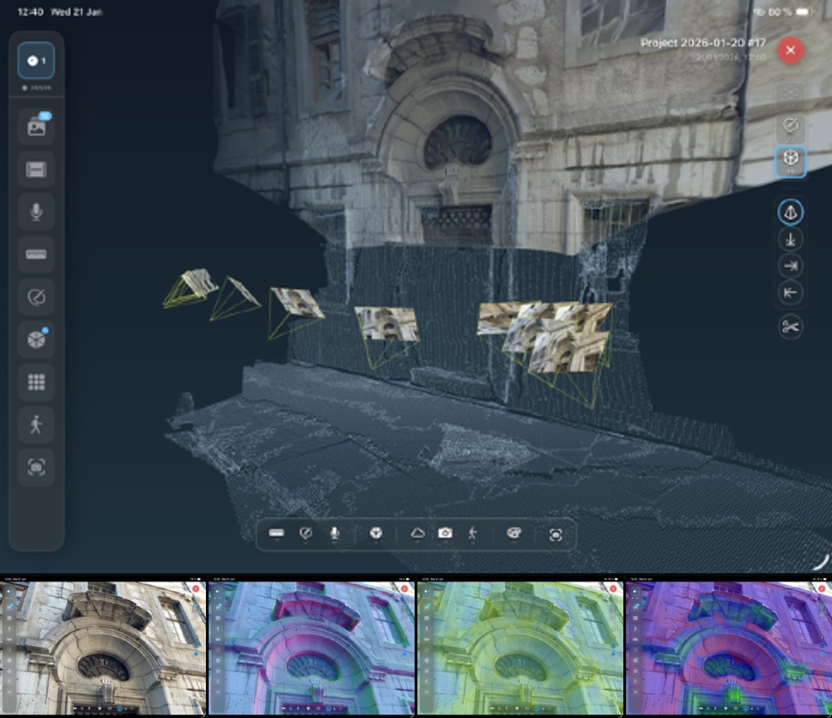
Observations remain aligned across successive field visits through versioned AR world maps, distributed frame anchors and drift correction — a cumulative spatial memory rather than a session-bound tracking snapshot.
Scientific paper · ISPRS Archives
The International Archives of the Photogrammetry, Remote Sensing and Spatial Information Sciences,
XLVIII-2/W12-2026, 129–136, 12 February 2026.
DOI:
10.5194/isprs-archives-XLVIII-2-W12-2026-129-2026
Field-based scientific and professional activities involved in the study and conservation of cultural heritage rely on observation practices that are inherently spatial, temporal, and interpretative. However, contemporary 3D digitization workflows increasingly dissociate data acquisition from interpretation, favouring exhaustive capture in the field followed by deferred analysis. This separation often leads to a loss of observational intent, reduced semantic coherence, and limited support for multi-temporal field studies. This paper presents dür.air, a mobile augmented reality application designed to reconnect acquisition, annotation, and interpretation directly on site. The proposed approach is structured around three methodological pillars. First, persistent spatial anchoring enables annotations to remain coherently aligned across multiple field sessions through augmented reality relocalisation. Second, a spatio-temporal semantic enrichment framework supports both synchronous (in situ) annotation and asynchronous (ex situ) interpretation, with consistent projection and reprojection between 2D images, depth data, and photogrammetric 3D models. Third, an interpretation-driven and frugal acquisition strategy explicitly links each capture to a scientific observation, reducing over-acquisition while increasing semantic density. Implemented as a fully mobile and autonomous system operating on a single handheld device, dür.air integrates augmented reality tracking, semantic annotation, and on-device photogrammetric reconstruction into a unified workflow. Rather than treating interpretation as a post-processing step, the system embeds it within the acquisition process itself, enabling cumulative, multi-temporal documentation. This work defines a methodological framework for field documentation in which augmented reality is used not only for visualisation, but as a medium for preserving scientific meaning in space and time.
Observations remain aligned across successive field visits through versioned AR world maps, distributed frame anchors and drift correction — a cumulative spatial memory rather than a session-bound tracking snapshot.
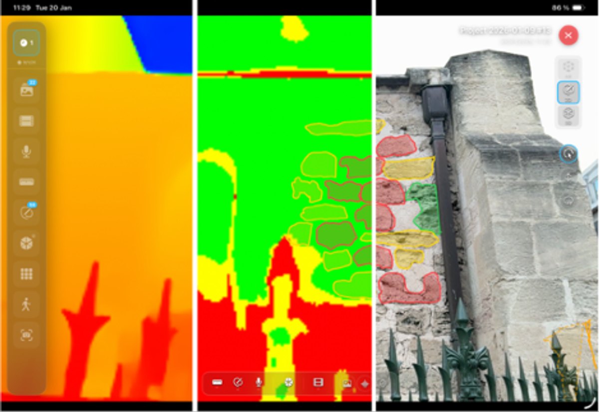
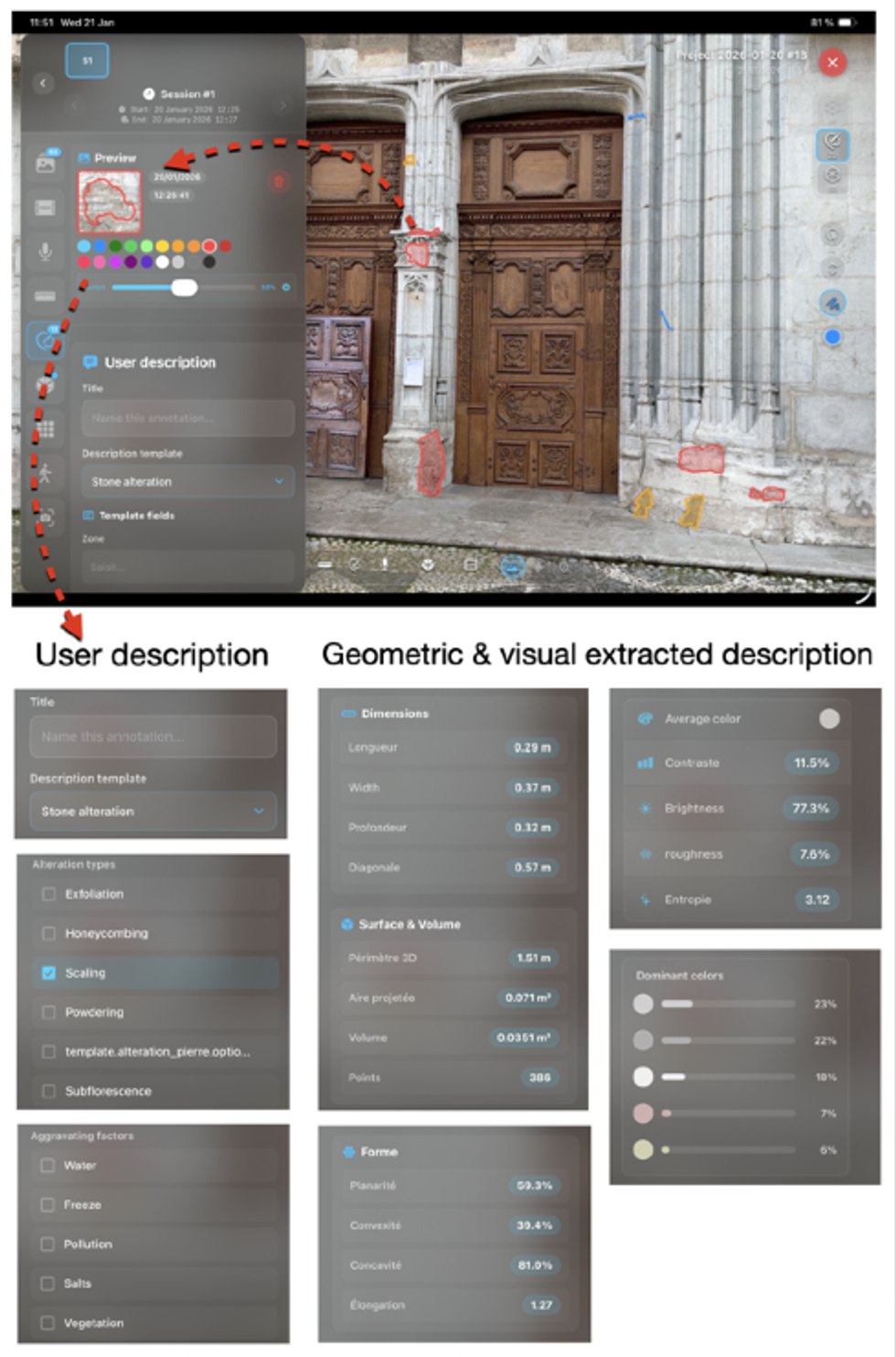
Each frame couples RGB, LiDAR depth, confidence and camera pose, so annotations created in situ can be reprojected onto images, meshes and orthographic views without losing geometric or temporal consistency.
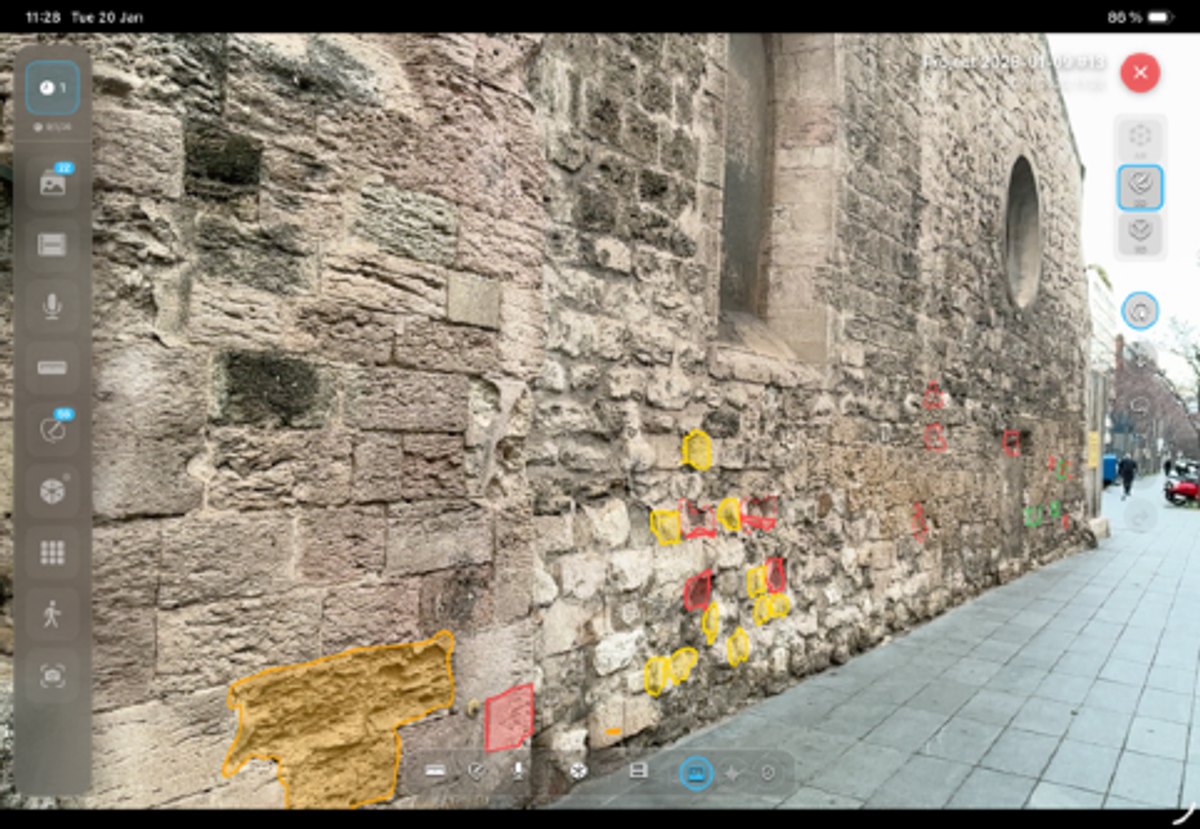
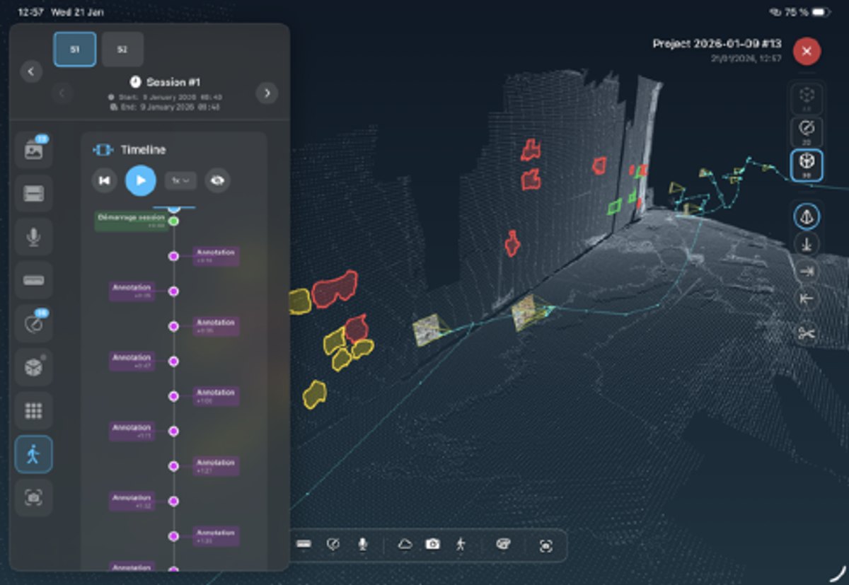
Capture is guided by observational intent. Sessions are recorded as camera trajectories with time-stamped events, favouring semantic density over exhaustive, uncontextualised data accumulation.
Illustrations from the article, shown here as a web companion. Full captions and discussion are in the original paper.
De Luca, L., Comte, F., and Pamart, A.: Dür.air: reconciling acquisition and interpretation in cultural heritage field documentation, Int. Arch. Photogramm. Remote Sens. Spatial Inf. Sci., XLVIII-2/W12-2026, 129–136, https://doi.org/10.5194/isprs-archives-XLVIII-2-W12-2026-129-2026, 2026.
@Article{isprs-archives-XLVIII-2-W12-2026-129-2026,
  AUTHOR = {De Luca, L. and Comte, F. and Pamart, A.},
  TITLE = {D{\"u}r.air: reconciling acquisition and interpretation in cultural heritage field documentation},
  JOURNAL = {The International Archives of the Photogrammetry, Remote Sensing and Spatial Information Sciences},
  VOLUME = {XLVIII-2/W12-2026},
  YEAR = {2026},
  PAGES = {129--136},
  URL = {https://isprs-archives.copernicus.org/articles/XLVIII-2-W12-2026/129/2026/},
  DOI = {10.5194/isprs-archives-XLVIII-2-W12-2026-129-2026}
}